Sebago to the Sea Trail FKT Route Trip Report – Chris Manwaring

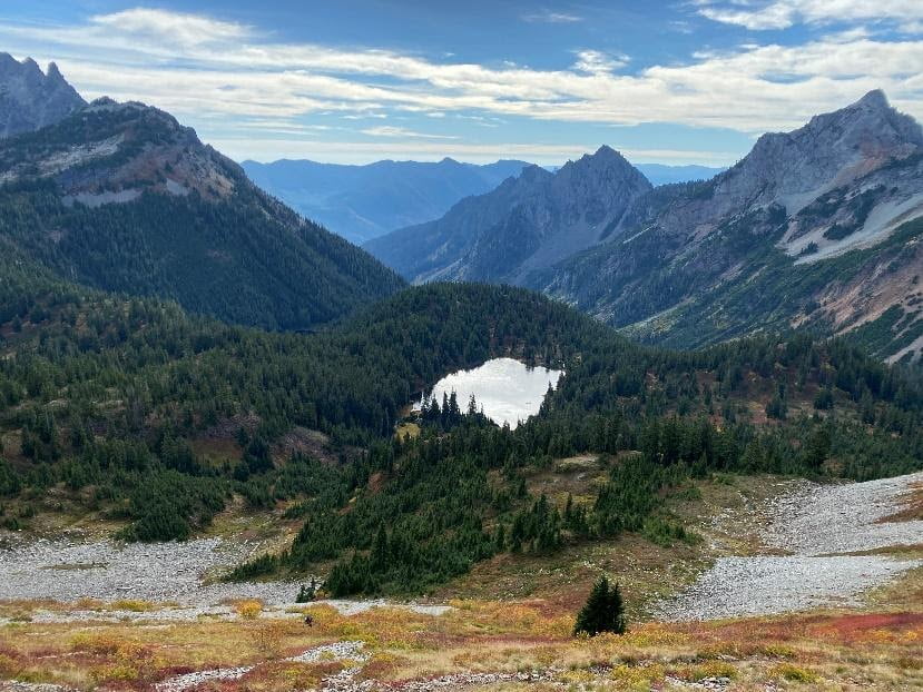
Name of “Event”: Sebago to the Sea Trail (a 30.2 mile FKT route)

Runner: Chris Manwaring

Race Date: 08/31/2024

Location: Sebago Lake to East End Beach, ME

Result: 7 hours and 10 minutes

Strava link: https://strava.app.link/Py5geYAkzMb

Chris Manwaring reaching East End Beach in Maine, completing the Sebago to the Sea Trail FKT route.
Gear – What did you bring?

Running vest (the Ultimate Direction FKT vest), old trail running shoes, 2 liters water with a water bottle filter, alongside general safety stuff.

Fuel – What did you consume and/or not consume?

My race nutrition consisted of PB&J sandwiches, GoGo squeeZ and Little Debbie Peanut Butter Creme Pies.

Logistics – What kind of planning was involved for both prep and implementation?
Some extra logistics are required since the event was point to point. For me, that meant leaving my car in the beach parking lot and getting a ride over to Sebago. The closest car access point is mile 1.4 on the trail, so I had to backtrack 1.4 miles to the start before officially starting the effort. Beforehand, I downloaded and studied the Sebago to the Sea Trail gpx file from the FKT page.
A map of the Sebago to the Sea Trail.

Find more info on the FKT website and the Sebago to the Sea website.
What went “right” or at least how you expected it to go?

I had a really great time out there on the Sebago to the Sea Trail! I kept a steady pace and moved well throughout. Fortunately, navigation was successful, especially with having the gpx file from the FKT site already downloaded onto my watch.

What went “wrong” or completely unexpected that you had to deal with?

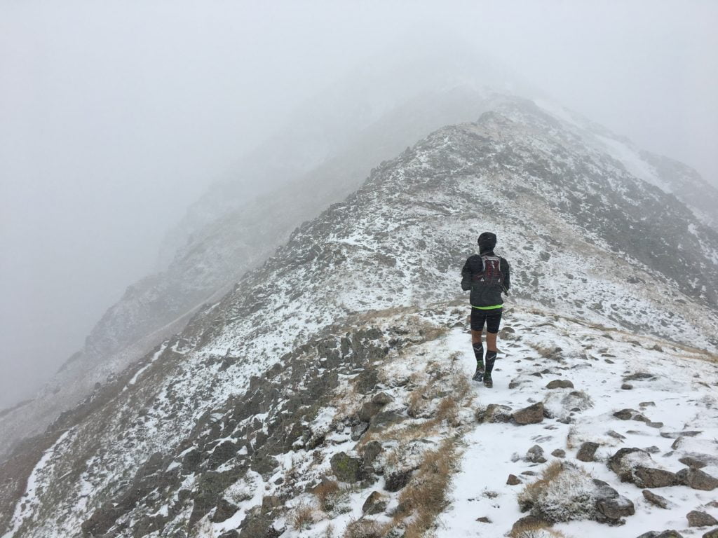
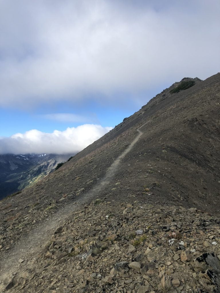
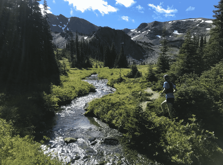
Not necessarily something that went “wrong,” but I didn’t really believe (or fully understand?) the description of section 4 that talked about a 3.5 mile stretch of rugged railroad tracks. While rugged is a term I generally use to describe the trails in the Whites, this section was the most technical on the trail. The gaps between railroad ties did not match my running stride length and the somewhat level, really thin stretch of gravel beside the tracks was so choppy it turned into a power hike patch. (see picture to the left)

Lessons learned for either the next trip or another’s first trip?

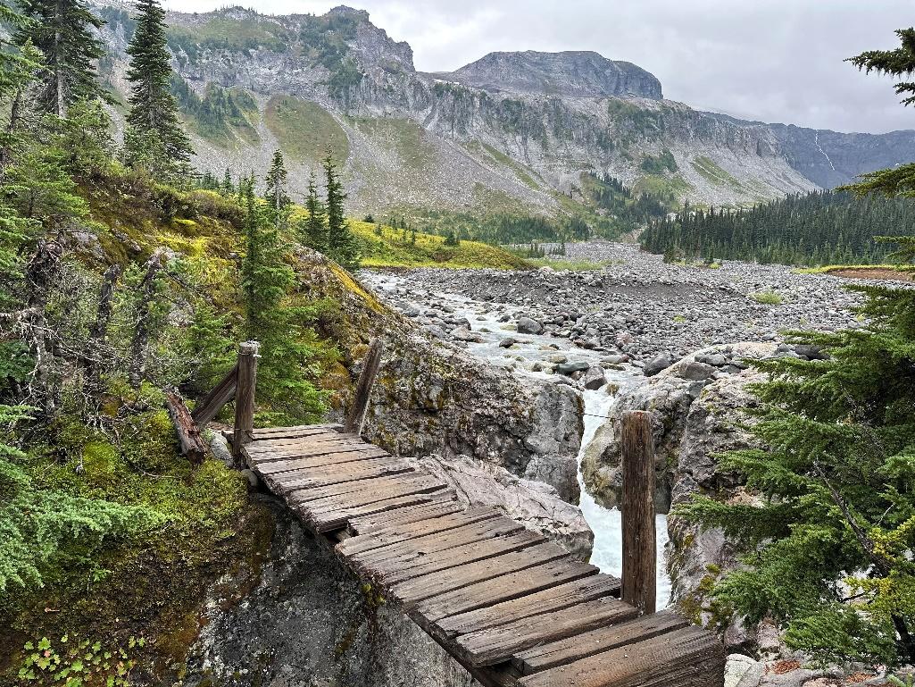
I’m definitely glad I had the gpx file handy: the Sebago to the Sea Trail signage is inconsistent since much of this trail route is actually just a long path connecting several different trail systems. Also, apparently there is a healthy population of water snakes that like to hang out in the first two sections, but luckily I didn’t see them! Planning water refills is important: I had my BeFree filter and filtered water out of the Presumpscot River in Westbrook, then out of a feeder stream in the Oat Nuts Park area.

Everything else!

It was lots of fun out there! There is nothing quite like staggering through a nice neighborhood in Portland with over 26 miles on my legs squinting for the trail markers! On a more serious note, it was super cool to connect Sebago Lake with the Atlantic on one continuous footpath. There are some stretches of road miles but the route sticks to trails whenever it can.

Interesting in reading about more FTK runs? Check out “Blue Hills Skyline Trail Double Out and Back FKT Trip Report – Keith Nadeau

Race2Adventure: Life-Changing Running Adventures

by Team RunRun Coach Brian Lettner and all pictures by Luciana Smania

Brian has raced around the world thanks to Race2Adventure’s life-changing running adventures. Directed by Merritt Hopper, Race2Adventure offers a unique concept that combines running with travel and exploration. Brian is one such Race2Adventure enthusiast who has been on multiple trips and shares why in this blog.

Brian Lettner on Race2Adventure

Sights from a Race2Adventure run

Nine days. Eight nights. An adventure to remember. An adventure for runners of all levels.

Brian on a Race2Adventure trip

I first heard of Race2Adventure through an email promotion in 2018. Noticing that this trip was right after my college graduation, I convinced my brother to go with me as a graduation present. The rest is history. I have been on four Race2Adventure trips now – Ireland, a Danube River Cruise through four countries in Europe, Norway, and Italy – with plans to go to Scotland in the summer of 2025.

How Race2Adventure works

What made it such an easy choice back in 2018 was the fact that Race2Adventure plans everything for you! In four simple steps – pay a flat fee, get your airline tickets, pack your bags, bring some extra money – you are all set. They find the best spots to stay, arrange transportation, plan cool activities, and most importantly, take you to the most epic locations.

Meeting new people: concerns of an introvert

However, Race2Adventure isn’t all about the views or the food or the little trinkets you buy along the way, it’s about the people. Merritt Hopper is your host, and he and his staff are some of the best people you will ever meet. The same goes for your fellow runners/adventurers. I have made some amazing friends on my four trips with Race2Adventure, and I believe you can too.

You might be saying to yourself that you’re an introvert. I would never make friends like that. Well, news flash, I am an introvert myself! That’s how easy it is to make friends on these wonderful trips and make the memories even more meaningful. Merritt asks everyone on the first night how many trips everyone has been on. At least half of the people raise their hand that this is their first Race2Adventure trip. So, bring a friend, family member, or go by yourself – just remember to make an effort to talk to the person next to you on the bus and to sit with someone new during meals. You never know, you might be running another race with them in the future or helping crew them at The Moab 240 (true story of mine). 

Oh, the places you’ll run!

Lastly, I want to get to one of the best parts of these trips…the racing. Merritt and his staff plan these trips years in advance, scouting the country (or countries) for the best spots to run. We are talking forests, mountains, oceans, and lakes. Add to that the Olympic ski jump and Atlantic Ocean Road in Norway. Even running through the streets of Pisa, Italy, plus many many more beautiful, and breathtaking spots. No matter your ability, these races and travel experiences will blow any other running event you have ever done out of the park.  

Now, I could go on and on about the details and memories I have of my past trips, and I am happy to either help you by coaching you for an upcoming trip or telling you more about my experiences (feel free to reach out). All I am saying is to give Race2Adventure a shot if you can. You will have some amazing memories, potential new friends, and grow in ways you never realized you could. I honestly can’t think of any better way to visit a new country!


Brian Lettner is a Pocatello-based running coach training runners from the 5k up to ultras, on both roads and trails. He can help runners fit training into an already busy lifestyle, as well as help with menstrual training.

Double Wonderland Trip Report – Mike Groenewegen

This is Mike Groenewegen’s Trip Report from his Double Wonderland Trail adventure in September 2023. Mike is an accomplished ultrarunner with top10 finishes in 200 mile races including a 2nd place at the Tahoe 200. But one of his major running goals for the past few years has been to complete the iconic Wonderland Trail in WA around Mount Rainier (93 miles and 24,000′ of vertical gain), to do it in a completely unsupported manner, AND to do two loops in one go! Mike is an amazing athlete and an amazing human – here is his report.

I have been dreaming about completing the double Wonderland unsupported for the last 3 years after 3 failed attempts.

Fueling the Adventure

A lot has been learned in each attempt, with a lot of that knowledge being centered around carrying more calories and managing the heavy pack. This time I switched to the Ultimate Direction 20L pack from the Black Diamond 15L and used primarily ramen instead of Spring Energy gels. Below is what the pack looked like going in. (In the end I did switch out two of the ramens for four spring energy gels because all of these ramen packs wouldn’t fit in the pack.) I only used two of the Summit Breakfast Scrambles which were in the plastic bags as the stomach couldn’t take any more. Six packs of ramen were remaining. A total of 18,000 calories were consumed by the end.

Route specifics

The FKT rules allow for any direction and starting point around the Wonderland but it felt important to respect the previous double finishers Ras Vaughan and Christof Teuscher who both started at White River Campground going clockwise and then counter-clockwise for the 2nd loop. Ras was the first to complete the double supported in 89 hours (https://fastestknowntime.com/fkt/jason-ras-vaughn-wonderland-trail-wa-2012-09-10) and Christof completed it supported and then doing it self-supported in 80 hours (https://fastestknowntime.com/fkt/christof-teuscher-wonderland-trail-wa-2020-10-04). Special thanks to these both for paving the way on the double and an extra tipped hat to Christof for being the only one to complete the loop 3x. 

The Adventure

Everything felt good starting at White River at 7:30am. The pack was heavy but I used Leukotape on the shoulders and the bottom of the back which stuck better than KT tape used a previous time. Stopped to chat with a backpacker after the Panhandle Gap who was hiking the Wonderland for the first time as a retirement gift to himself. He was on his last day of the trip and there was a childlike happiness in his eyes and voice. It was the first of many moments with others on the trail where this journey never felt unsupported.  

Before Indian Bar Camp

The pack weighed heavy on the body and mind but the spirits were good. Finished the gels in the first 5 hours and then switched to cold soaking ramen which were being consumed every 3 hours for part of the first loop and then every 2 hours after. Used the bobo bars whenever a break was needed from the ramen. While the ramen was never fun to consume, eventually found a rhythm as how to best take them in where I would soak them for 45 mins in a Talenti cup before consuming them and then needing small bites to finish them by the 2nd loop. Learned to fill the Talenti cup with water for the dry stretches and then dropping the noodles in 45 mins before eating. 

It was a big moral boost making it to Indian Henry’s cabin by sunset as I had done during my previous 3 attempts. Took in the pastel colors on Tahoma behind the Ranger’s cabin and remembered why it’s my favorite viewpoint on the trail.

Indian Henry Cabin

Longmire to Mowich has always broke me when starting from White River with the five big climbs and descents. Made it a point to get to Mowich campground by morning and then after made it a goal to finish the first loop by sunset at White River. When all hope felt lost, I would set the alarm to sleep for 30 mins which usually ended up being 15 min dirt naps in the emergency bivvy. After the nap I would eat while thinking about the support felt and had to repeat the sleep/eat/positive thinking several times that first loop. In total got around 2 hours of sleep over the 77 hours. 

Finished the first loop in 35:54 before sunset which was faster than my previous 2 double attempts. Even though there are no fkt unsupported rules about needing to carry all your own trash, I originally had planned to carry all it for both loops but felt uneasy during the first loop naps with the smell of the garbage possibly attracting wildlife. Decided to throw away the garbage at White River for that safety reason. While I respect the true nature of being unsupported, safety is more important to me and I made up for it in other ways by not listening to any music and never messaging anyone outside of the trail other than once to MapShare after the first loop. 

Had wondered what it would be like going into the second loop after the previous failed attempts and was surprised to feel a sense of calm. At Carbon River that feeling disappeared upon breaking the Leki pole when it slipped on a boulder which drove me down a deep low that took several hours to climb out of. During the first loop before Longmire, I had dropped the water filter of the bottle into a whirlpool of a river. It sank to the bottom of the pool that was over 6ft deep as it slowly made a circle and I accepted it being gone forever as it headed towards the rapids. It miraculously kept circling before surfacing right where my hand was where I had dropped it. Another time earlier in the first loop I thought I had lost my fork and had accepted needing to eat the noodles with my fingers the remainder of the time before finding it in a pocket. Even though all the big climbs in the 2nd loop were still to come, the gratitude of having the filter and fork overpowered not having poles and got me eventually out of the deep low.

A river running through a forest

Description automatically generated

Carried 2 500ml soft flasks which always felt enough for the clockwise loop with the many water refills but for going counter-clockwise I wish I had another bottle for the long climb up to Golden Lakes as there was no water for about 12 miles. It was amazing experiencing Mowich to Longmire when it was light out after all the previous double attempt loops were in the dark. Where everything in the first loop was during the day and night, the second loop was reversed. It felt very special to fully experience the trail like that.

A heavy rainstorm set in upon reaching Emerald Ridge at the 3rd sunset and it would keep coming down through the night. Found a dry patch under a tree to sit by Indian Henry’s cabin in the middle of the night. A passing runner who was doing the loop for his first time joined me and we talked for 15 mins about many small things in the pouring rain that felt like many big things in that moment. 

Before Panhandle Gap

It wasn’t until the 7-mile and 3,000ft climb up to Indian Bar Camp where there was a full focus on trying to finish below Christof’s 80-hour double record. Could have used an extra bottle for this dry stretch and it like the climb up Golden Lakes gave a full appreciation of the difficulty of the loop when experiencing it going the other direction. There were many emotions upon seeing the Panhandle gap knowing the end was close and feeling a tremendous happy/sad about closing this chapter after dreaming about it for 3 years. Made it back to White River campground in 77:01 hours, with a heavy gratitude for the experience.

Massive congrats to Mike for this new FKT! Mike is a long time member of Team RunRun and we’re so proud of him for all the puts into his running and all that he gives back to the community. If his Double Wonderland Trip Report has inspired you and you’re interested in finding a coach to help you with your adventures, you can search 100+ coaches to find the best fit for you.

FKT: Across Hawai’i Volcanoes National Park – Rachel Mason

Runner: Rachel Mason

Name of “Event”: FKT: Across Hawai’i Volcanoes National Park

Date(s) of event: 06/16/2023

Time to complete: 09h49m

Location: Hawaii Volcanoes National Park

Strava Activity Link: https://www.strava.com/activities/9279427019

Gear – What did you bring?

Took my 30L Ultimate Direction Fastpacker (nice pack, horrible color, worse name), just because I wanted to carry poles and a lot of water. I carried a windshirt, very basic first aid kit, headlamp – and poles and a lot of water. I decided to wear full-length leggings and a sun hoodie; I decided that not getting all scratched up in long grass was more important than maybe being a bit cooler. I wore La Sportiva Bushidos (or Akash? can’t remember what they are), which are pretty substantial shoes that feel safe on bare rock.

Fuel – What did you consume and/or not consume?

OK so I haven’t exactly got this down to a fine art. I like those nut butter Clif bars but they’re $11.99 for 5 here so I bought fig bars instead (raspberry flavor, actually). I complemented them with a big bag of chips and a side of these big crunchy cookies from a local bakery. This was topped off with a bag of crystallized ginger aka magic beans and paired with some delectable Nuun tabs. Mmmm.

Logistics – What kind of planning was involved for both prep and implementation?

This whole thing came about because I was looking at maps of the national park while plotting some backcountry explorations, and I realized you could in theory string together a load of trails into an uninterrupted crossing of the park, and it would be about 50k. I had broken my foot last year during one of said backcountry explorations, and I decided that this route would be my first big trail run after coming back. To make it a bit more fun I submitted it as an FKT route a couple weeks before my target date, and it got accepted!

For training, Coach Des had me first build up road mileage, then transition to trails for a few weeks. This felt like a good approach. I made sure to put in some time on the actual trails along the route, to get used to the terrain (an awful lot of lava rock) and get a feel for being out in a very remote, hot, and windswept environment.

On the day, my partner dropped me off shortly before sunrise at the Footprints trailhead, and picked me up at the Pu’u Loa trailhead in the afternoon. Along the way I filtered water at two backcountry cabins/shelters; I must have drunk a good 6 liters in total.

Where to find the info on this:

https://fastestknowntime.com/route/across-hawaii-volcanoes-national-park

What went “right” or at least how you expected it to go?

I mean, I finished it? And in the last few miles I did this thing that was slightly faster and more tiring than walking; let’s be generous and call it running. There were some really nice points along the route as well. Setting off below the vast bulk of Mauna Loa starting to turn pink in the sunrise; a small but delightful forest about 18 miles in (basically the only shade that whole day); looking down on the beach at Halape and planning to come back with a hammock and some mai tais; the amazing variety of lava colors and textures in the last 8 miles – that kind of thing.

What went “wrong” or completely unexpected that you had to deal with?

OMG MY FEET. The trail was very overgrown around the 10-mile mark and my feet got soaked and started to rub. I did stop a few miles later to dry them in the sun and brush off the sand (actually volcanic ash), but that wasn’t enough. Soon I had blisters on both heels and the balls of my feet were rubbing as well. Also, the trails are so rocky that every step was some fresh discomfort from stepping on yet another hard, pointy lump. One of the blisters popped a mile or so before the end and that wasn’t pleasant at all.

One other thing is that when I stopped to use the outhouse at the Pepeiao cabin there was a little nest in there with three dead baby birds in it. That was sad and depressing and for some reason made me feel lonely. I put on a running podcast after that, which helped. (Actually it was the one where Coach Des talks about Cocodona, which was great except that bit about feet was a bit much).

Lessons learned for either the next trip or another’s first trip?

Mainly, deal with your feet and take some fresh socks.

Everything else!

So there was this long stretch in the middle where I just walked the whole thing, because it was uphill and the ‘trail’ was just a load of rocks hidden under grass. And at that point I didn’t feel like an ultrarunner at all, just a person doing a very long hike. And I was like “this is going to take 10 hours, that’s 3 mph, how is that a respectable pace, what is the point of this?”. But having had time to digest the whole thing, I’m now just happy to be a middle-aged woman who can push through 31 miles of pretty gnarly trails and still be in one piece at the end. Well, apart from the feet. The feet have opinions about this whole thing…

Some Gorgeous Pictures!

Grand Canyon: Rim to Rim to Rim with Coach Natalie Collar

Runner: Coach Natalie Collar

Trip: Grand Canyon: Rim to Rim to Rim

Date: 04/04/2022

Time to complete: 16 hours

Location: Grand Canyon, Arizona

Strava Activity Link: https://www.strava.com/activities/6933486256

Gear – What did you bring?

  • Ultimate Direction Ultra Vesta
  • 1.5L hydration bladder
  • 500mL soft flask
  • Katadyn 1L water bottle filter
  • Altra Superior shoes
  • t-shirt
  • shorts
  • light windbreaker jacket
  • Coros Apex Pro Watch
  • Trail Sisters trucker hat

Fuel – What did you consume and/or not consume?

  • Spring Energy Awesomesauce (5)
  • Honey Stinger Waffles (2)
  • Honey Stinger Chews (3)
  • Jolly Ranchers
  • dried mango
  • peanut butter-filled pretzels
  • chocolates
  • Spring Energy Electroride (1L total)
  • drank almost 10L of water

Logistics – What kind of planning was involved for both prep and implementation?

At this time of year, the North Rim is still closed, so no parking or services are available there, which left two options for starting at the South Rim. You can either take the South Kaibab Trail or Bright Angel Trail down to connect it with the North Kaibab Trail. Since I didn’t have anyone to give me a ride in the morning or pick me afterwards, I opted for the Bright Angel Trailhead, because parking is right next to the trail, whereas South Kaibab Trailhead is a couple miles away from the parking. Distance-wise, South Kaibab is a little shorter than Bright Angel, but if you have to cover the extra distance on foot to the parking lot, it basically evens out.

I was staying in Flagstaff which was less than a two-hour drive from the trailhead, so I’d recommend staying here if you’re not staying in the Grand Canyon village.
There are water sources along the way at the various campgrounds along the route, but researching this information was difficult and unclear. When I did the route, the water sources were turned on at: Indian Gardens, Phantom Ranch, Manzanita, and this was just enough to stay hydrated throughout the day. My strategy was to fill up with as much water as possible when I came to a water source, especially as the temperatures warmed up.

Where to find the info on this

I found the route details on the Trail Run Project website and Strava. I recently found a Facebook Group for Rim to Rim to Rim info, including up-to-date water access info, and the name of the group is: Grand Canyon R2R2R Run! https://www.facebook.com/groups/grandcanyonr2r2rrun

What went “right” or at least how you expected it to go?

Route finding was pretty simple as I expected. There were more public restrooms than I expected, which is always nice for a long day on the trail, too. Nutrition and fueling went well, too. No upset stomachs, no dehydration, no falls or blisters (yay!), and STUNNING views along the way. The weather was also perfect, and even though it got up to 75-80 at the peak of the day, there were maybe 1-2 moments where I actually felt too hot. In fact, until 10 am, we weren’t even in direct sunlight, which was awesome (We started just before sunrise at 5:30am).

What went “wrong” or completely unexpected that you had to deal with?

My legs were actually pretty gassed after the initial descent of 6-7 miles, even though I was taking it easy, so dealing with the unexpected fatigue from so early on was a little challenging. I wouldn’t say I had the best day physically or mentally and almost nothing felt easy, but I definitely enjoyed being on the trail.

Lessons learned for either the next trip or another’s first trip?

  • I ran out of water once, just due to being stubborn and ready to be done at the end. I passed through Indian Gardens, which is just under 5 miles from the top of the South Rim, and I thought I had 500mL left, but only had a couple sips. Luckily, I was with a friend who had a bit more water left, so we shared. It was also dark and temps weren’t too high.
  • Another lesson for me was that 48 self-supported miles was just a tad too long for me. I’ve done several 20-30-mile self-supported runs, as well as many 50-mile+ races, so I wasn’t expecting this to be too different, but it definitely was! After 35 miles or so, I really just wanted warm food and an aid station, and would’ve paid so much money for a burger or ramen.
  • Finally, this is definitely a route I will only be running once, but there are so many other adventure routes in the Grand Canyon that I’d love to put together a shorter one and continue exploring this beauty.

Everything else!

  • This was a bucket list adventure run for me–48 miles, 11k of up and down–so I feel incredibly proud to have completed it! I had been to the North Rim once before, but only hiked down a mile or so, so almost the whole route was completely new to me. It was such a treat to see such gorgeous and unique views throughout the whole route. We had ideal weather and trail conditions, too, so I highly recommend this route at this time of year before it gets too hot. I did heat train for this run, by hitting the sauna and hot yoga a couple of times, but I was totally unaffected by the heat.
  • We saw quite a few other parties of runners along the route, either completing the full double crossing or some other variation. We also saw many hikers and one party of mules, so although it was a long self-supported adventure, it definitely wasn’t a remote alpine-esque route where there are only a handful of people on the trail.
  • I think I will remember the feeling of being so small compared to the canyon walls the most. You look up, and you can’t even see the top of the walls. While you’re up higher in the canyon, and you look down, you can’t even see the bottom. I don’t think there is a name better and more fitting than the Grand Canyon. It was unlike any feeling I’ve had while running in the Colorado mountains.
  • Finally, my recovery from this run has been pretty ideal. The initial day or two of soreness, fatigue, and stiffness where there, but after a day in the car and an epsom salt bath, most of the soreness has dissipated, and it feels like I will be back running soon!

Natalie is a coach with Team RunRun. To learn more about her or work with her, check out her coaching page.

Additional Trip Photos:

pct section j

PCT Section J Trip Report – Mike Groenewegen

On October 9th, Mike set out to run an out and back on Section J of the PCT in Washington State. He shares some of the highlights here (well, lowlights depending on your perspective!) of the attempt. Strava route: https://www.strava.com/activities/4200773905

pct section j

After running 64 miles for 22 hours I came out of a sleepwalk in the middle of the night to find myself going hypothermic. It had been pouring rain and then cold weather set in. I was so close to the turnaround point of my 148 mile out-and-back attempt on the Section J of the Pacific Crest Trail (PCT) in Washington. As my body temperature plummeted, I realized I was going the wrong way back up the mountain where I had just come from. I had to keep moving to stay warm so I continued going back.

I was carrying 2 emergency blankets and an emergency bivvy but I couldn’t get any sleep with the blanket in the cold rain. During a previous multi-day run, my body temperature had dropped after waking from a nap which was in warmer and dry conditions. Not wanting to risk that again in the current conditions, I resorted to micronaps of several seconds of sleeping to keep functioning. As I climbed to the higher elevations, the rain turned to snow.

The ridge was fully exposed with heavy wind. I had to rely on my headlamp’s light that barely penetrated the flurries and a GPS app on my phone to lead the way. When the trail wasn’t being buried in snow at the higher elevations, it was becoming waterlogged at the lower levels. Streams turned to rivers which had to be forded in the middle of night while sleep deprived. After going back to the higher elevations with now a foot of snow on the ground and having been awake for 46 hours, I lost my phone.

My only navigation was gone. I usually carry a GPS and tracking device that can 2-way text and send SOS messages to local authorities. During previous multi-day runs earlier in the summer, it had weighed me down mentally and physically so I left it at home. I retraced my steps in the snow and felt my heart race the many moments I thought I found the phone. After fruitlessly searching, I had to move on. A month later someone posted on a local trailrunning Facebook group they had found a phone in the snow on this trail. These pictures from the journey are not lost thanks to him.

pct section j

It was now light out which helped better navigate the trail. I came to a section and noticed an old trail sign carved from stone partly hidden in the snow. I dug in the snow around it and found more stones with faint letters and thought I had found relics of this storied trail. Continuing on, I realized all the rocks had inscriptions on them. The hallucinations from the lack of sleep had begun.

My sense of direction and judgement quickly deteriorated. Having lost the trail under the snow, I decided to cut across the valley going cross-country down the mountain to Joe Lake. Desperation grew as I failed to find a way out of the valley and approached the 60-hour estimated completion I had given a friend. Exhausted and defeated I tied one of the emergency blankets to a trekking pole and waved it in the air while blowing an emergency whistle. Then I noticed on the ridge a person watching with a dog. I waved the pole harder and higher and blew the whistle louder expecting any second to see them come to my rescue. But the shadowy figure and dog were another hallucination.

pct section j

I slept in the emergency bivvy under tree cover that provided some relief from the rain. After several hours I woke to my friend sleeping close by who I had given my itinerary to. The hallucination eventually faded away during the night but it helped me get 10 hours of sleep. Energized, I found Gold Creek trail that runs parallel in the valley to the PCT. A raging river had to be crossed with water up to my waist where every step was consequential. After reaching the end of the trail hours later, I ran to the nearest cabin. I needed human contact again having not seen anyone since the morning 3 days ago.

As the couple gave directions, I cradled myself in their words with immense gratitude. After getting to a main road, someone stopped to drive me to my car a few miles away. I had returned after 80 hours and 140 miles. A King County sheriff was there waiting and I would learn my friend with the itinerary had reported me missing that morning. The sheriff had coordinated Search and Rescue teams that went looking for me. He was about to publicly broadcast I was missing on the trail. I shed the first of many tears knowing my selfishness impacted the ones I love and the Search and Rescue volunteers. They deserve better. And so, I will be better.

grand loop fkt

The Grand Loop FKT Trip Report – Keith Laverty

grand loop fkt report
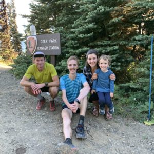
Runner: Keith Laverty
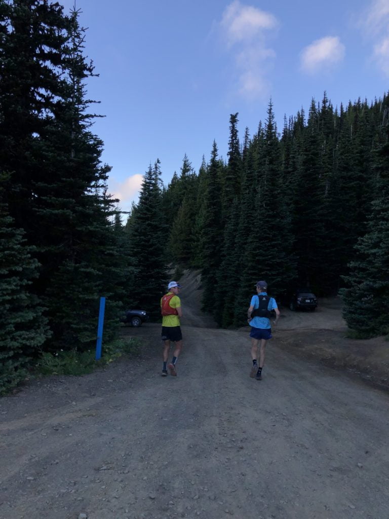
Adventure: The Grand Loop FKT attempt with Max King (my coach!)

Date: 09/02/2020

Time to complete: 10 hr 40 min 49 sec

Location: Deer Park – Olympic National Park

Strava Activity Link: https://www.strava.com/activities/4003810712/overview

Gear – What did you bring?

  • HOKA Torrent 2 – I broke in these newer model of trail shoe in the few weeks prior, especially on long runs. Good grip and it had enough support.
  • Salomon S Lab Sense Ultra 5 Set pack with whistle – Stretchy, lightweight and enough to carry everything I needed.
  • Suunto 9 with GPX file of route pre-loaded
  • rabbit FKT 3″ short
  • T8 boxer brief
  • rabbit team kit short sleeve shirt
  • rabbit long sleeve
  • rabbit lightweight cap
  • Buff
  • Stance Run360 socks
  • Backup lightweight windbreaker jacket
  • Emergency blanket, first aid kit, Spot X, Salomon water filter cap

Fuel – What did you consume and/or not consume?

I took in mostly a wide assortment of Spring Energy gels, couple packets of energy chews, one Picky Bar (ended up being too sticky to swallow) and one Bearded Brothers bar (also ended up being too sticky to swallow). Several handfuls of wild huckleberries and blueberries along Gray Wolf River Trail.

I did **NOT** consume nearly enough electrolytes (see section below on how things went horribly!).

Logistics – What kind of planning was involved for both prep and implementation?

Since we went for the Unsupported FKT category and easy decision since the Grand Loop is mostly remote anyway, especially once you pass the Obstruction Point parking lot around Mile 10. It’s fairly straightforward logistics in that, you just need to be self-sufficient and carry everything you need for an all-day mountain run.

The drive up to Deer Park is a long, windy road to the top and the loop starts/ends above 6,000′. Conveniently, there is a campground at Deer Park too (less than 20 sites) but it’s first come, first served, so try to avoid summer weekends but you can easily turn the loop into an overnight trip. Don’t forget to have a national park pass.

Where to find the info on this

https://fastestknowntime.com/route/olympic-national-park-grand-loop-wa

I first heard about this route a couple of years ago when I went to search for all of the FKT routes in my backyard – there are currently 10 on the Olympic Peninsula!

What went “right” or at least how you expected it to go?

With both of our watches having the route pre-loaded plus closely studying the route online, there was no need or worry about navigation or route-finding. There were a few tricky spots where the trail would be eroding or non-obvious but it was easy to pick up the trail again.

I had enough calories and filtered water; plenty of refreshing creeks to cool off and refill my flasks, especially as I was trying to keep my temperature down toward the later half of the loop.

Despite all of my struggles and cutting it close by the skin of my teeth (by only 8 minutes!), we came away with the overall FKT which was the main goal, so I was very grateful for that. I don’t see this FKT lasting for too long after this!

What went “wrong” or completely unexpected that you had to deal with?

A lot more went wrong than expected on this journey, and specifically, for me only!

As early as around Mile 18 heading toward the 2nd major pass (Cameron Pass), I already felt some twinges and nearly debilitating muscle leg cramps in my right quad and my left hamstring. This was a “try not to panic” moment. I still had a packet of Tailwind to use up, along with some Bolt chews that had some electrolyte in it (but not much), I quickly realized that I was going to have delicately ration the rest for the remaining 25 miles… Ouch. I tried a couple of stretches that Max recommended to me and tried to consciously think about activating my glutes more. Any time I lifted my legs higher or tried to run any incline, my muscles cramped up again.

We seemed to had built up a large buffer by Cameron Pass but then that margin slowly and painfully dwindled away all the way until the finish.

Thankfully I was able to maintain consistent movement (but including a bee sting for good measure!) on the long 10-mile descent to the bottom of the Three Forks final climb, which is 4 miles and 3100′ of gain. I began to power-hike this section pretty well for several minutes but once again, I faded hard and went spiraling down into some dark mental demons and doubts. Barely keeping my head in the game, taking several full stops to try and stretch and mustering the smallest of “hello’s” to the few hikers I saw. My mantra’s I kept repeating to myself were “One step in front of the other” and “I want to see my family” – knowing that both Elisa and Luke were waiting for me.

Overcoming this challenge was something I know I’ll be able to carry through in future races and FKT attempts.

Lessons learned for either the next trip or another’s first trip?

  • Bring extra packets of Tailwind and/or some backup electrolyte capsules/chews such as GU Roctane capsules or SaltStick chews.
  • Be prepared for a lot of climbing but also a lot of steep, big descents.
  • Be prepared to be blown away by the remote landscapes and likely marmot whistles!

Everything else!

I’ll definitely remember this FKT and adventure run for years to come and being able to share that with my coach. And those multiple post-run charley horses. I have a feeling that I will be back to give this loop another go.

The very next morning, Elisa went out on the loop solo, and on a hotter day than mine, and set the women’s FKT in 11:15 and 3rd fastest time overall! Right after my run, Max mentioned to Elisa that she should try and beat our time – and I think that really got Elisa pumped for her run.

Keith Laverty is a coach with Team RunRun. To learn more about him or to work with Coach Keith, check out his coaching page.

grand loop fkt

grand loop fkt

grand loop fkt

grand loop fkt
Photo: Max King

grand loop fkt
Photo: Max King

grand loop fkt

discovery park seattle

Disco Inferno – Running an Ultra in Discovery Park

Mike G is a runner with Team RunRun and after crushing his race at the Houston Marathon in early 2020, he decided he wanted to take on a different challenge: Cover as many miles as possible in Discovery Park in Seattle, WA, all unsupported, all within the park hours. The goal was 100 miles but the experience took on much more meaning than any time or mileage goal. This is a summary of his experience, the challenges he faced, and the emotions he went through.

We love this awesome sport and Mike’s challenge to himself, in light of the fact that “official” challenges of races are continually cancelled or moved, and it’s an inspiring example of why we can find gratitude in the fact that in the end, we still have running.

Check out his Strava route here, aka His Love Letter to Discovery Park.

Disco (in Latin): to learn; Inferno (in Latin): of the lower regions. Later became associated to something hellish and suffering.

If the running community were a gang, “Learn by suffering” would maybe be one of our collective tattoos. We have all suffered during a run and had to overcome it and when we have, it has made us better. This is why I took on running 100 miles unsupported at Discovery Park in Seattle or as the locals call it, Disco. I needed a hard reset and running a bunch of miles to my breaking point seemed like a good way to do that.

Discovery Park is Seattle’s largest park with 534 acres (2.16 km2) of land that consists of forests, beaches, prairies and bluffs. It contains 12 miles (19km) of trails which can be combined in many ways with my favorite being a roughly 4-mile loop that passes through all those different areas with about 500ft (152m) of elevation gain. My plan was to run this loop as much possible and then stick to the higher and flatter ground loops until I hit 100 miles. I chose to do it unsupported which has different meanings in the running world but I follow the FKT (fastest known time) rules of carrying everything you need from start to finish except water and not being accompanied unless you start and finish together.

Everything was awesome the first 6 loops. I was curious if repeating them would affect me but they didn’t. I never thought about them as loops, they just ‘were’, and every step was a new step. This might seem like a mindfulness feat but it was more from tiredness. The parks hours are 4am-11:30pm and I ended up using every minute of it. After 6 loops, the running on mixed surfaces of trails and pavement and the rolling hills with steep staircases had caught up to me. I stuck mostly to the higher ground trails from then on but my legs and feet were not happy.

After mile 37 I started taking breaks whether it was to watch seals in the water or the sunlight dance on the water with the majestic Olympic mountains in the background. It was magical. The focus during races is often running as fast as possible that such experiences are never fully realized. I knew I wasn’t going to make 100 miles anymore and I didn’t care. I had hit the reset button and felt hundreds of emotions overflow within. I was ready to give up several times during the low points but the love and support from you guys kept me going. The suffering eventually ebbed away to be replaced by an enormous love and gratitude. This coupled with the support felt from TRR carried me to the parks closure where I finished with 91 miles (146km) and 9,028ft (2752m) of elevation gain with nothing left in the tank.

I woke up the next day feeling freer and lighter than I had in a long time. Overcoming something we don’t think we can do is also learning something new about ourselves. We don’t need races to do this, just the will and maybe some disco inferno.

discovery park seattle
Credit: Torrin Maynard

discovery park seattle
Credit: Joe Mabel

4 pass loop maroon bells

Four Pass Loop Maroon Bells Trip Report – Jeff U

4 pass loop maroon bellsThe Run: Four Pass Loop – Maroon Bells – Snowmass Wilderness

Where: White River National Forest, near Aspen, CO

Who: Jeff U and Teddy B

maroon bells 4 pass loop

When: 9/23/17

Distance: 26.5 – 28.5 miles (depending on where you park and/or if you get lost like us)

Elevation gain: approx. 8,500′ – 9,000′

Strava Links:

https://www.strava.com/activities/1200494915/overview

https://www.strava.com/activities/1198287311/overview

4 pass loop maroon bells

Logistics:

Parking: There is day-use parking right by the trailhead and long-term parking not far away (approx. .5 mile). You have to pay $5 for a day parking pass, and I believe $15 for a 5-day pass. Parking is free with a National Parks Pass.

Lodging: There are campsites around the area; however, they were all full when we got there (late). I believe this is something you would need to book fairly far in advance depending on season. We went on what was said to the busiest weekend of the year due to the Aspens changing colors. Aspen is the nearest town which is probably the most expensive town I have ever experienced. Lodging is outrageously expensive, even a room at an Airbnb. We ultimately slept in the car in the long-term parking area, and moved our car to the closer day-use parking for the day.

4 pass loop maroon bells

The Route:

Route-finding: The trail is fairly easy to follow, though we managed to get lost in the first 4 miles. I still don’t know how that happened, but pay attention when you’re around the river, so you don’t miss the proper crossing area. Aside from that, the trail is super easy to follow assuming you know which passes you’re targeting (West Maroon Pass, Frigid Air Pass, Trail Rider Pass and Buckskin Pass). There are no signs for the loop itself; however, there are signs for the various passes. The only potentially confusing part is by Snowmass Lake where you can take an extra trail down to the lake only to return back to the main trail towards Buckskin Pass.

Terrain: There are some solid climbs, some of which are not very runnable. It gets rockier and more technical towards the tops of the passes, and things can get a bit messy with the weather up there. The first couple miles are also uncomfortably rocky, so it’s tough to get in an early rhythm. There are also a lot of really nice areas with clean downhills and/or smooth flat trails to help make up time.

Weather: It’s Colorado, so the weather in the mountains is super unpredictable. Take the weather forecasts seriously, and make sure you are thoughtful about your cold weather and rain gear. It can be dicey up on the passes.

4 pass loop maroon bells

What to Take:

Water: Water could potentially be an issue depending on the weather and/or how comfortable you are drinking directly from a mountain stream/trickle. It was cold and wet when we ran, but I still managed to empty my 1.5L Salomon bladder after only the third pass. We took a chance and refilled our water from a gentle trickle of a stream crossing the trail at one point. I wish I would’ve had some kind of purification, but thankfully no excessive poos followed. There are a handful of streams and lakes you could potentially use to refill, but again, do so at your own risk without purification.

Food: I would be sure to have all of your food for the run as well as before/after the run before you get to Aspen. If you’re heading to Aspen from Denver, you will pass a Whole Foods in Frisco, right off I-70. We managed to find a cheap pizza spot in Aspen called New York Pizza. They have a gluten free option, though I’m not sure about the vegan situation. You can buy giant slices of pizza for $4.50 – $5.00 or a whole pizza for roughly $15-$20. It is likely the best deal in town, otherwise, you’re probably stuck getting something in Leadville or even as far back as Frisco.

Gear: Depending on what time of year you go, I would make sure you have enough fuel (food/water), rain gear if there is any cold or rain possible, hat, and gloves. I don’t think it’s really any different than any other mountain race or route. It’s likely to have a mixture of hot, cold, wet, dry depending on when and where you are on the route.

4 pass loop maroon bells

Lessons Learned:

I don’t believe I had a cell signal at all when we were out there, but I eventually put it on airplane mode since my battery was dropping so fast.

One thing that was a surprise was how long it took. We took our time, but we still definitely underestimated how long it would take to complete the loop.

This is one of the most beautiful runs I have ever done. Even with less than ideal weather, it was still absolutely amazing.

4 pass loop maroon bells